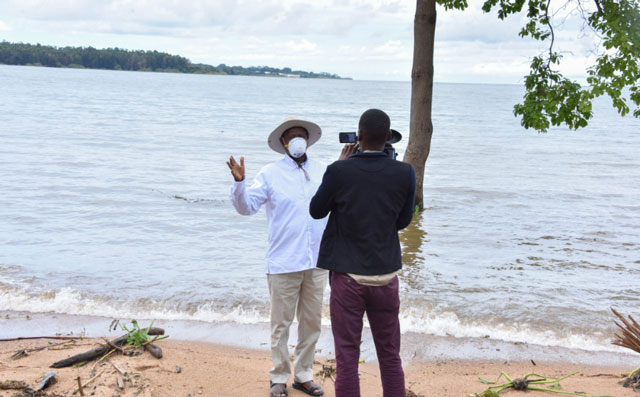
🔸 Lake Victoria RECORDS
📌12/05/1964 ⬆ 13.41m
📌19/05/2020 ⬆ 13.49m
Entebbe, Uganda | THE INDEPENDENT | President Yoweri Museveni has described Uganda as the best country in the world, narrating the marvel that Lake Victoria is, in his latest missive.
“Uganda is the best country in the World. I always marvel at some Ugandans that look so desperate to travel to other countries, almost all of them not as endowed and as beautiful as Uganda,” he said, before sharing a history of the rise of the water levels of Lake Victoria
FULL TEXT BELOW
*******
Know your country
It is always good for the Bazzukulu and even the adults to know their country. Uganda is the best country in the World. I always marvel at some Ugandans that look so desperate to travel to other countries, almost all of them not as endowed and as beautiful as Uganda. On this occasion, I will inform the Bazzukulu about the few facts I have on Nalubaale (what Europeans call Victoria) and Kiira (what the outsiders know as Nile). We cannot talk about the two without talking about Mwitanzigye (Lake Albert), Kyooga, Masyooro (Lake George) and Butuumbi – Rutshuru (Lake Edward).
The Bazzukulu can check for themselves from the different reference points about the size of each lake in sq. kms., etc.
What captured my interest when I was growing up, was the level of the water in these Lakes and Rivers over the last 120 years, ever since the new Government (following the colonization) had started keeping records. The water-level is measured at Jinja.The lowest level of the water was in 1923 when it was 10.28metres.
Before that, the highest level recorded had been in 1918 when, on the 1st of January, the record showed 11.89metres.I had heard about these heavy rains of 1917/1918 from 2 sources. Some of the historians of the KAR had referred to them during the 1st World War.
Secondly, my mother, Esiteri Kokundeka, always told me that she was born during the time of the heavy rains. There was also another elderly lady, Komukyeera, which meant that she had been born when the heavy rains had just stopped. She was from the Bahiinda clan.
The next high record was on the 16th of May, 1964, when the water level reached 13.41 metres. By this time, I was very much around and I was 19 years old, in S.IV at Ntare High School. Those rains had been steadily building up the water, eversince 1961. By 1962, the plains of Kashaari, where we were grazing our cattle that time, were flooded. It was quite a bother splashing in water in the plains day after day in our rugabires or the more unhealthy cha-cha plastic shoes. The plains of Ruyoonza, Kakigoonjo, Rweera, Kyarwabugaanda, etc., were all flooded. The only way you could escape water was if you went to the hills of Rugoobwa and Kaigoshoora. On the lake shores, most of the landing sites and piers were rendered unusable. Actually, that is when lake transport was interfered with. Soon political turmoil set in and there was nobody to worry about much of the lake transport to Butiaba, Bukakata, Namasagali, etc. Only Port-Bell and Jinja survived. I know this because I used the ship Victoria in July, 1967, from Port-Bell to Mwanza.
During the El-nino of 1997/1998, the water-level reached 12.97metres on the 17th of May. The water went up but it did not reach the level of 1964. However, since last year, the water level has been going up. The highest level was on the 19th of May, 2020, when the water level reached the new record level of 13.49metres. Since that time, the water level has remained above 13 metres. Even the morning of the 15th of September, 2020, my 76th birthday, the water level is still at 13.04metres. The people who settled too close to the Lake shores, should move away from the Lake Shores. Staying 200 metres from the Lake shore is the wise, correct and useful thing to do. When you do that, vegetation and forest grow around the Lake shore. That vegetation is like a filter for the omukoka that goes into the Lake (the mutuunga, the run-off water, Alele, etc). The filter, keeps the soil in the vegetation and only the clean alele goes into the lake. Thereby, the Lake avoids silting and mineral nutrients do not go into the Lake, which phenomenon attracts aquatic plants that take oxygen from the Lake and can lead to the extinction of fish. The Lake is also clean for swimming ─ no pollutants ─ and, therefore, for tourism and drinking water that does not require too much cleaning by the National Water and Sewerage Corporation. It also looks beautiful to look at.
Also, keep 50 metres away from the River Banks for the same reason. It should only be in a few areas where the engineers of the Town or City Council, allow some permanent buildings within the zone of 200 metres from the lake-shore or 50 metres from the River banks. I can authoritatively speak on this because I was born near one of the tributaries of the Kagyera ─ Kyamate-Katiinda Kifuunjo (papyrused tributary). Recently, I bought back part of my ancestral land at enkoondo and the papyrus there is totally undisturbed. It is not only beautiful but the water preserved for irrigation and the swamp grasses can be used for mulching. Papyrus can be used for making paper like the Egyptian did 3 millennia ago. Fish farming can be done by cages in the Lakes or in fish ponds near the river banks.
YKM, the Oldman with a hat
16th September, 2020
 The Independent Uganda: You get the Truth we Pay the Price


